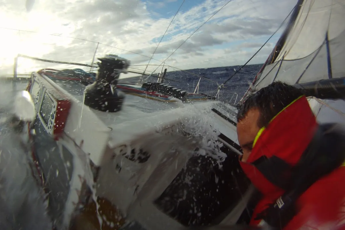
Image: Sailing in the Roaring Forties
Cape of Good Hope: the route to the Cape of Storms
Cape of Good Hope: a name that hides its dangers
The Cape of Good Hope was initially called Cape of Storms by the navigator Dias who first reached it, without being able to round it, arriving from Europe. Its calming name derives has nothing to do with prevailing weather conditions but from a secondary aspect that was much more important at the time. With the discovery of the Cape of Storms, the hope was concretely opened that the Indies could be reached by sea.
The King of Portugal John II, decided to change its name to “Cape of Good Hope”. It was the end of the fifteenth century, sighted by Dias in 1487, rounded by Vasco de Gama ten years later.
This was the time of the great explorations by sea by the Portuguese. By trying another route, the Italian Christopher Columbus discovered the Americas in 1492, initially thinking that he had already reached the distant lands of the Indies.
The three great capes: Hope, LLeewin and Horn
These are the three great capes that mark a non-stop circumnavigation. Starting from Europe, the first to round is precisely the Cape of Good Hope, we will soon talk about its dangers. It is the cape that marks the passage from the South Atlantic Ocean to the Indian Ocean and is located at 34 degrees South of latitude. The second cape that to be rounded is Cape Lleeuwin, which is much less known. This is because in reality those who undertake a circumnavigation pass much further south. This despite the fact that the cape is also at 34 degrees South, just like the Cape of Good Hope.
However, from a meteorological point of view it makes no sense to approach Australia to round cape Lleewin. Going north from the roaring 40s route you risk headwinds and areas of light winds. Those who plan their route will typically head for South East Cape, the southernmost tip of Tasmania located at 43 degrees South. Cape Lleuwin is therefore important merely for its geographical significance, its longitude marks the transition from the Indian Ocean to the Pacific Ocean.
For those planning a non-stop passage, they will have to consider South East Cape in Tasmania first, then Slope Point. This second cape represents the southernmost tip of New Zealand and is located at the latitude of 46 degrees South. From there the next target however is the most legendary and feared of all three capes, Cape Horn. The dreaded cape is actually a Chilean island marking the narrowest point of the Drake Channel. An island nestled between South America and Antarctica, a treacherous place for several reasons. In addition to weather conditions, the sudden rise of the Atlantic seabed from thousands of meters to a couple of hundred can create extremely dangerous sea conditions.
Atlantic Ocean and Pacific Ocean meet at the Cape of Good Hope
Cape of Good Hope therefore marks the passage between the South Atlantic Ocean and the Indian Ocean. The dangers that characterise it are many and they certainly were for the first navigators who reached it sailing in unknown waters. From the point of view of the prevailing winds, the dreaded South-Eastern blows here, very often, a strong wind from the South East. It is clear that for the ancient sailing ships and clippers, approaching the Cape following the African coast meant encountering very strong headwinds.
This made the Cape often difficult to round despite several attempts. The short windows that open with different winds are fleeting, shut down quickly and the prevailing headwinds return. The South-Eastern is strengthened by the presence of the continent and is the distant echo of the south-east trade winds immediately south of the doldrums.
The long route from Europe to the Cape of Good Hope
In addition to the South-Eastern that we would encounter trying to round the Cape of Good Hope, the difficulties are several for those departing from Europe on this route. Starting from Northern Europe, we must first of all deal with the Bay of Biscay. This is the big bay between the French and Spanish coasts. The reason why it is a very treacherous area is due to two factors. The first of a practical nature, the traffic of fishing boats is considerable.
The second factor is the same that makes Cape Horn so dangerous, the sudden rise of the seabed. The storms that hit Europe bring before the cold front strong winds from the South-West. The winds make the sea rise and with the associated rising of the seabed it the seas becomes steep, with breaking waves and treacherous. We have to add to this that the wind then rotates to the North-West as the cold front passes. The new wind brings a new train of cross waves. When two waves add up, they can double in height compared to the average, which can be dangerous indeed.
Cape Finisterre
After crossing the Bay of Biscay the next turning point is Cape Finisterre. Here the wind tends to strengthen a lot with very strong prevailing winds from the North-East. 40-50 knots are normal intensity the rounding of the is not to be taken for granted. We have to add to this that all commercial traffic directed to North of Europe inevitably passes in front of this cape. In fact, there is a traffic separation zone to avoid which must be avoided in order to stay out of commercial shipping.
The Portuguese trades
The route to the Cape of Good Hope, from Cape Finisterre is still very long. However, there are some good news at this stage, we could in fact encounter the Portuguese trade wind – which is a local wind and must not be confused with the actual trades. This steady wind blowing from the north along the Portuguese coast. If we met it we can make fast progress to the South. This wind ends near the Strait of Gibraltar and we will still have to face many miles of navigation to get to catch the proper trade winds. The trades that blow from autumn to late spring from the North-West at a latitude between Canaries and the Cape Verde Islands.
The transition zone between Europe and africa
After the Cape of San Vincenzo, the southernmost tip of Portugal, the north wind fades rapidly. From there it will be necessary to negotiate the passage of the Canaries which are often surrounded by light winds. The weather conditions can lead to very different choices at each step. Often you end up staying far to the east, heading towards the Moroccan coast first and then towards the first of the Canaries. When we are near Lanzarote we will once again have to choose whether to pass between the mainland and the islands. Sometimes you can take advantage of an acceleration of the winds passing between Tenerife and Gran Canaria. In any case, the passage through such high volcanic islands is always delicate. Leeward of the islands are very large cones of disturbed and weakened winds from the islands. If the conditions allow it, you can definitely head west and pass outside of the entire archipelago.
Getting to the trade winds
Once you have passed the Canary Islands, you should gradually enter the area affected by the trade winds. Ocean race tackle this route in October/November when the trade winds are not yet fully formed as it is the case in January. For this reason, great gains can be made to find the fastest route to the trades. Getting to the trade winds first can mean maintaining this advantage up to the Cape of Good Hope.
The navigation in the Northwest trade wind north of the doldrums is the most pleasant. The free ride, however, does not last very long and the attention will be focused on deciding where to cross the Pot-au-noir. French name for the doldrums. This belt sees the north-west trade wind blow to its north, the south-east trade wind to its south. In the fall the belt is situated at approximately 6-7 degrees North. therefore it is encountered before the equator along our route to the Cape of Good Hope.
Cape Verde islands
The Cape Verde islands are right in the trade winds. Considerations regarding possible accelerations to be exploited and shadow cones to be avoided also apply to these islands. Many choose to pass to the west of the archipelago, others end up crossing them. On the way to the Cape of Good Hope this is one of the many choices we have to make.
The doldrums
If you wanted to find a new synonym for the word frustration, pot-au-noir or doldrums would be fitting. The navigation in the trade winds stops quite quickly with a sudden drop in the wind. From here on you will struggle with light winds trying desperately to cross a belt of less than 200 miles of unpredictable winds. After the light winds you meet squalls and gusts of wind with very violent meteorological events. The problem is that everything changes suddenly, from nowhere a cloud overwhelms you with 30 knots of wind and then spits you out into the calm. All this is even before you even had the time to finish putting in your reefs!
We must insist and gain ground to the south, at all costs. As soon as we hear the first gust of headwinds we will know we are almost there. These weak winds from the south-east are those symmetrical to those we left when exiting the north-west trade wind. Mile after mile they will stabilise and strengthen until they are strong and stable. Southeast is exactly the route we should take to go to Cape of Good Hope. This means that instead of heading straight towards the goal we are forced to make a very long additional detour to get to our destination.
Crossing the equator
The passage of the Equator is more a symbolic moment than a real stage from the point of view of the navigation. Leaving the doldrums on our way to Cape of Good Hope we will be sailing at speed in the trades when crossing the equator with all the time for a little celebration. Offering Neptune an alcoholic drink is a good omen and in the boredom of the trade winds a tradition that can be respected as a moment of relaxation.
Fernando da Noronha
Cracking slightly the sails and letting the boat run in a broad beat or near-reach, we will head for a small island 180 miles off the coast of Brazil. Fernando da Noronha together with Isola de Rata are at the latitude of Fortaleza. They are located just north of the easternmost part of Brazil: our route will always pass near these islands. The regular and sustained trade winds forces us to take this route without many alternatives.
The transition from the trades to the depressions systems
Ferdinando da Noronha is at 4 degrees South still in the full swing of the trades, roughly symmetrical to the Cape Verde islands. We will have a fair number of miles to sail further south before things change. The good news at this latitude is that we a nice rotation of the wind which improves our heading.
However, even if the free ride can be boring, this navigation doesn’t last forever. Soon the tropical conditions, the sun, the heat, the steady wind, will abandon us. After Ferdinand of Noronha you’d think you could set sail for heading for Cape of Good Hope but it is not so yet.
The St. Helena High
The direct route between Ferdinando from Noronha to Cape Town passes not far from the Island of St. Helena where Napoleon was imprisoned. The island, however, is much more famous for sailors because of the name it gives to the high pressure area known as Sant’Elena. This is none other than the southern mirror of the high pressure of the Azores. However, unlike the high in our hemisphere, this tends to be much more stationary. The only choice we have is to continue our navigation towards the South and to the west of the high. This, until we meet the first depression and the first winds that can take towards the Cape of Good Hope.
Tristan da Cunha and Inaccessible Island
Our route, instead of heading towards the Cape of Good Hope, will gradually curve with the rotation of the trade winds. We will be able to sail towards Tristan da Cunha, an Island in the middle of nowhere between America and Africa at 38 degrees South of latitude. Yes, to reach Cape Town (or the Cape of Good Hope which is located at 34 South) we will be forced to go further. to the south. An old saying says “go to Tristan da Cunha then turn left”. This remote island is in fact already nearly in the roaring forties, the latitude where we feel the influence of the depressions that perpetually turn around the globe in the screaming 50s.
Atlantic depressions form around the Argentine coasts in a similar way to those that generate near New York and Boston directed to Ireland. Unlike in the Northern Hemisphere, conditions are already much harsher and more severe at these latitudes. This is because there is nothing equivalent to the Gulf Stream which keeps the water temperature high even to the North of the Azores.
Leaving the north-east trade wind and continuing south, everything changes abruptly and becomes gloomy and threatening. We know we shouldn’t be tempted to “turn left too early” but wait patiently for the first “express” train in the form of a low system. In fact, when we reach the roaring forties, it will be up to our luck and navigational skills to hitch onto the first depression. In the space of a day we will forget our shorts and we will suddenly we’ll be wearing our full three layer foul weather clothes which we don’t quite expect at such latitudes, especially in comparison to the North Atlantic. But these are not called the Roaring Forties by coincidence. However, the good news is that they will finally take us to Cape of Good Hope.
The roaring forties and the final stretch
After playing cat and mouse and waiting for the first depression, finally poking his nose into the roaring forties, everything will change. In a moment we will find ourselves riding an angry beast with winds often over 40 knots average. Waves that will finally launch us straight towards the Cape of Good Hope.
We know that when we get close to the Cape, if our destination is Cape Town, we will meet the famous South-Estern. So having 34 degrees south as our final destination, we will have to continue sailing in the roaring forties and then come up to Cape Town much later. This also as we want at all cost avoid getting out of the influence of southerly depressions and be sucked into the light winds on the edges of the St. Helena high to our north.
The last effort
Continuing along the roaring forties we will have to carefully read the weather maps so as not to go up too soon. In fact, if we did it and approached Cape Town at 34 South we would find ourselves upwind in the dreaded South-Estern. Gritting your teeth you have to get almost under Cape Town before making a sudden left turn. If instead we were to round the Cape of Good Hope we would never go up to see the cape, indeed. We should keep our distance to avoid the South-Eastern and continue sailing in the regime of the roaring forties.
Cape Town
If our final destination, as in many races in stages, is Cape Town, the time will come to move up in latitude. If we have done our homework well we will be able to hitch onto the the South-Eastern on a reach rather upwind. By doing this we will be able to arrive quickly and safely to Cape Town. There is no shortage dangers, especially with the numerous fishing boats so hard to dodge at night. But, the sight of Table Mountain in Cape Town after several weeks of sailing will be unforgettable. Cape of Good Hope which is immediately south of Cape Town, so by arriving in Cape Town we have not rounded it yet.
Leaving Cape town
A non-stop navigation avoids the problem of rounding Cape of Good Hope against the South-Eastern. This however was something unavoidable for the early explorers. The same goes for those arriving and departing from Cape Town, having risen from the roaring forties they will have to negotiate the South-Eastern blowing again. Those who do not make a stopover look good and stay well south of the Cape of Good Hope when passing it from afar.
For those departing from Cape Town, the winning strategy is not to attempt to go East immediately. Instead, it’s best to insist south until we out of the influence of the South-Eastern. This means that from Cape Town we will sail south or even south west to return to hitch onto a passing low pressure system. At that point we can aim for the next big cape, Cape Lleeuwin, thousands of miles away.
At the passage of the latitude of the Cape of Good Hope, where the Atlantic and Pacific Oceans meet, we can tell that we have finally rounded one of the three great Capes. Think of the great navigators of the fifteenth century and what difficulties they encountered. Without all this information, many expeditions will have failed in the calms of the Gulf of Guinea. Many people will have died in the absence of wind in the huge high pressure bubble of St. Helena.
Cape Good Hope and False Bay
Others, on the other hand, finally arrived near the Cape of Good Hope, not aware of the treacherous South-Eastern, will have taken it on the nose. Many will have lost their boats or ended up against the rocks in the bay next to the cape. Sadly famous for the number of wrecks and which bears the name of False Bay.
The old ships that could not sail close to the wind, and without knowledge of the local geography, would foolishly head North-East after the Cape of Good Hope, finding open seas only to discover that they were sailing into a bay. Once deep into the bay they could not tack their way out of False bay and were eventually overcome by the South-Eastern that would push them to shipwreck in the bay.
YOU CAN DO IT
Around the world
Single-handed
Non-stop
By the three great capes
With a unique format
Budget friendly
Starts in A Coruña 2023
Click here for more on the Global Solo Challenge
Text: Marco Nannini
Text and image courtesy of Global Solo Challenge
Racecarmarine race a J/80 race boat - Justify - with Racecarmarine branding in a number of events on the South Coast of the UK and have a good understanding of the marketing requirements for businesses in the marine sector. Contact us for details on how we can help with your project.